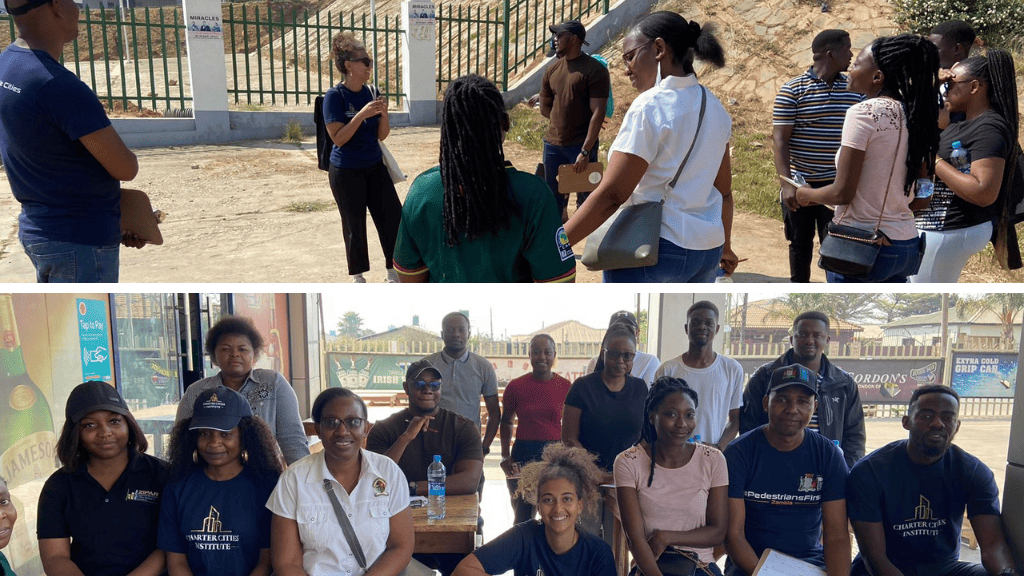
CCI Zambia’s Walking the Un-walkable project aims to document the pedestrian experience in Lusaka. It is centered around four walks, each of which maps different spatial environments across the city, completed by relevant stakeholders. On the first walk, the project team and the stakeholders co-mapped the route often taken by students to access the University of Zambia. The second walk passed through the biggest markets in Lusaka, mapping local access to goods, services, and job opportunities.
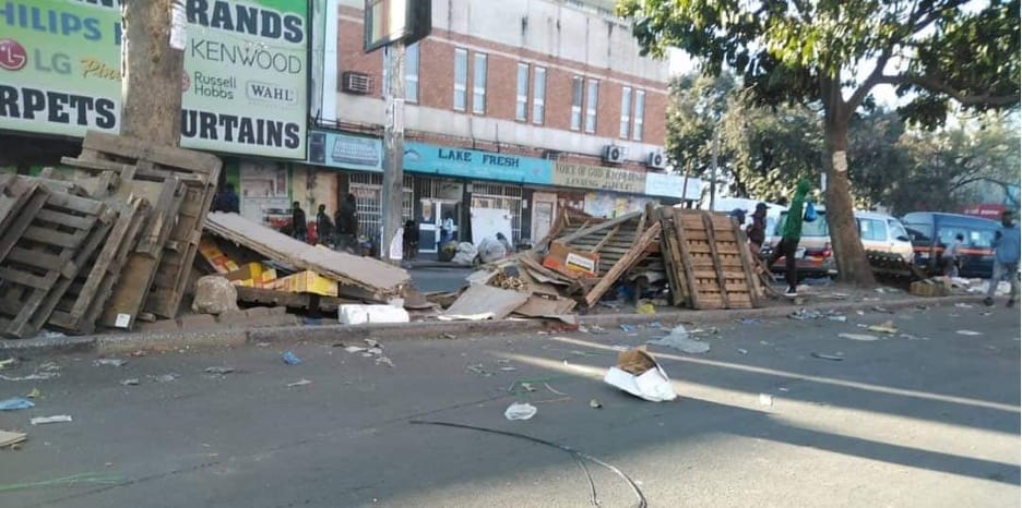
On the second walk, we survived a walk into the downtown markets of Lusaka, questionable samosas, and ZamCabs. However, if you felt inspired by our walk in the markets and want to replicate it, you might get completely different results. On July 18th, the Ministry of Local Government and Rural Development (MLGRD) and the Road Transport and Safety Agency (RTSA) ordered the removal of street vendors from downtown markets. As of writing this, the path that we took is now mostly empty and vendors are protesting to be allowed back into the area. The official press statement by the Ministry indicated that solid waste, drainage, illegal erection, and a lack of safety standards, among others, were reasons for the relocation. The vendors claim they pay levies to the local council and that they should be allowed back.
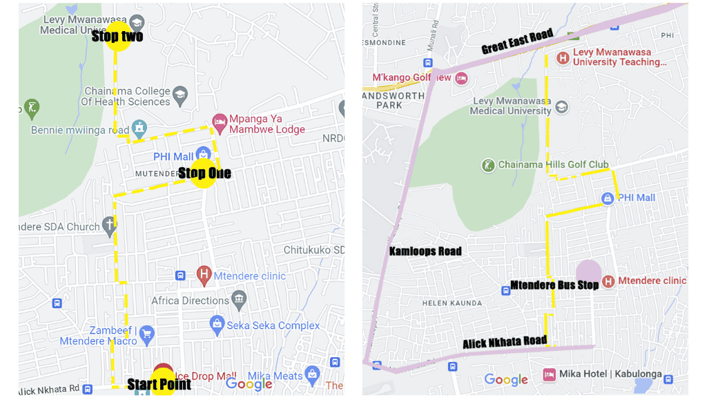
For our final walk, we visited a high-density township called Mtendere Compound. It is located close to main transportation routes and formal, lower-density neighborhoods. “Mtendere” is a Nyanja word meaning “peace,” which I’ll be adding to my very limited Nyanja vocabulary. This walk focused on measuring accessibility (to transportation nodes, services, economic activities, and recreation spaces.)
We started the walk at Alick Nkhata, a main road in Lusaka that connects many neighborhoods together. We walked towards PHI Mall, where we had our co-mapping activity with some far less questionable samosas. The last stop was at Levy Hospital, which connects straight to Great East, another main urban high connecting many neighborhoods in Lusaka and beyond.
Access to Transportation
As we started the co-mapping exercise, we asked everyone to rank Mtendere’s access to transportation. It didn’t take long for one UNZA student to rate it 10/10. In the middle of Mtendere, there is a bus stop. It’s a 20-minute walk from the bus stop to access Great East, Kamloops, or Alick Nkhata (three main roads). You can take a bus from any of those routes that will help you access almost anywhere in Lusaka. Buses going to “Hospital” or “Town” pass by the three bus stops. Mtendere earns that 10/10!
Economic Activities
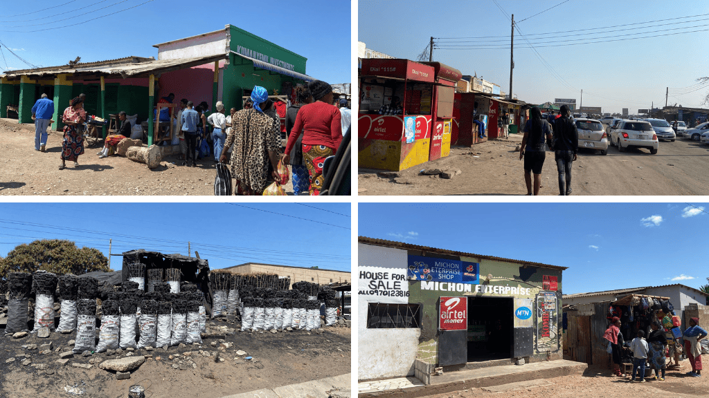
We started the walk from Alick Nkhata Road at Ice Drop Mall. Our second stop was PHI Mall. Connecting Ice Drop Mall (a rather smaller mall) to PHI Mall is a long stretch of smaller shops along a route that stretches throughout the compound. In the middle of the compound, there is an official Mtendere Market. One can buy, sell, or find anything in those various shopping places. You can do your hair, fix your bike, buy a live chicken, or a dead pig, or even go to church school. The one shop that caught the participants’ attention is the “More Life” Hair Salon. It doesn’t just do your hair, it gives you life! Mtendere is in the middle of many formal neighborhoods in Lusaka, which makes access to local labor markets outside the compound easy via walking or public transportation. The inside of the compound remains productive, with very good connections to the outside job hubs.
Recreational Spaces
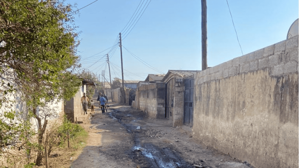
Many of the walk participants quickly concluded that no recreational spaces were inside the compound. We saw no green spaces, except for some trees lurking behind private homes’ walls. One participant quickly reminded us of the little boy who almost hit 3 of us with his broken-down bike, not even glancing at us. We then noticed many kids playing in the street or screaming “muzungu” at me. The many women chatted in front of their homes. We quickly realized that the streets themselves were recreational spaces. The small scale of the streets keeps them shaded. The bad conditions of the streets make them a nightmare for cars, but a perfect spot for playdates and gossip.
Connections and Links
Mtendere Market, PHI Mall, Levy Hospital, and the two main routes of Great East and Alick Nkhata Road make the area easily orientable. If you walk East, you are heading towards the Mtendere Market; North is Great East, and South is Alick Nkhata. The number of different functions along any route you take is also a great way to orient one’s self. I do have to admit in the few times I have walked this route, I might have missed a turn or two.
Services
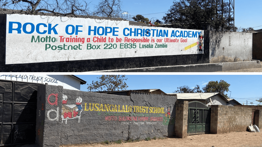
Mtendere has a clinic, many churches, a primary school, and shops that sell practically anything, including a Pikachu blanket that I was really eying. Levy Hospital is also located within the compound. All those services are within walking distance. Access to those services and economic activities is harder for the rest of sprawling “formal” Lusaka, which often requires people to drive to access them.
Which school are you sending your child to?
I wish I could say Mtendere surprised me in any way. It didn’t. The findings of Mtendere are aligned with what the literature tells us about informal settlements. Informal areas are often situated near job markets. Mtendere is no different. It is well located with accessibility to many formal areas and jobs. Informal areas are often productive and mixed-use. Again, as our co-mapping activity showed, there are so many job opportunities within the borders of Mtendere itself. Mtendere, like most informal settlements, is walkable. Almost everything can be accessed within a 20-minute walk. Most streets don’t hold car traffic, making the streets safe for a walk.
Mtendere also shares a lot of the negative aspects of informality. Drainage systems are close to nonexistent except along the main routes. Rainy seasons in Lusaka are bad, with frequent flooding that can ruin businesses and lives in an instant. We have already learned how the flooding in Kalingalinga transforms the students’ path from a 15-minute walk to over a 90-minute one. Tenure security is another issue. While most Mtendere residents have formal land titles, some do not.
Mtendere does have its issues, but as a group, we have agreed that it is one of the safer routes we have walked thus far. It featured much less traffic, with fewer Zam Cabs and private cars, while also featuring much more shaded space.
Towards the end of the activity, we reflected on the walkability elements we mapped together. There were no sidewalks present. No traffic signs. No crosswalks. No seating. No intentional shading. The roads are not paved. Those main “perceived” infrastructure elements of walkability weren’t there. However, what was there was mixed-use, density, accessibility to transportation, services, and shops. The small-scale streets provide natural shading, and the lack of cars makes walking safe and chill. In a sprawling city like Lusaka, where the car is dominant, there is much to learn from a place like Mtendere.
Mtendere made us wonder, do we really need well-designed sidewalks to improve walkability, or should we opt for small-scale shared streets style development? Or is it a mix of both? What role do economic activities and market proximity to residential areas play in the future development of Lusaka? Can we learn lessons from those informal areas on walkability? How can we truly solve drainage issues in such places? And how efficient are traffic-calming measures compared to traffic-reducing measures? And which way should Lusaka go?
This is the third walk of four walks where we co-map the experiences of walkability in Lusaka. In this third walk, more than anything, it’s becoming clear that private cars, sprawl, low densities, and the separation of functions remain walkability’s number one enemy.
Stay tuned while we delve into our last walk and map the garden city together.