Genova: The Evolution of the Role of the Bisagno
The Context
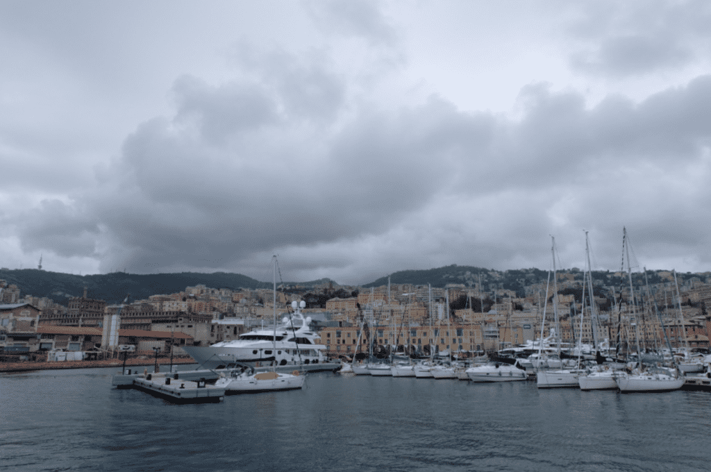
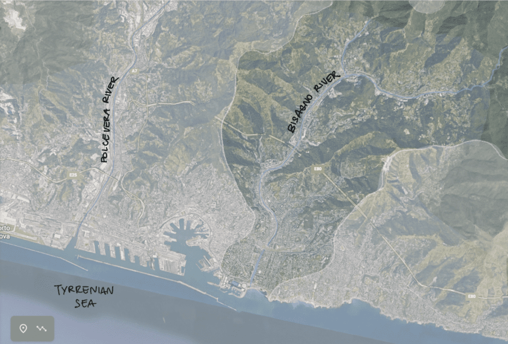
Genova is an Italian city with a population of around 600,000 people. It is located in the northwest part of the country, by the Tyrrhenian sea. The identity of the city has been built around the port and its trading activities. The city has been one of the marine republics, along with Amalfi, Pisa, Venezia, and others. The surrounding topography has strongly influenced expansion patterns of the city. The gulf presents a steep coastline, with the Apennines Mountains extending right behind the shore. Genova developed in a linear shape, framed by the water and hills. Two major rivers cross perpendicularly along the urban strip, the Polcevera and Bisagno waterways. The Bisagno can not be described as a relevant player of any economic development phases of the city due to Genova’s coastal nature, however the river system has been a central topic of urban discussions due to its flooding behaviors.
The River
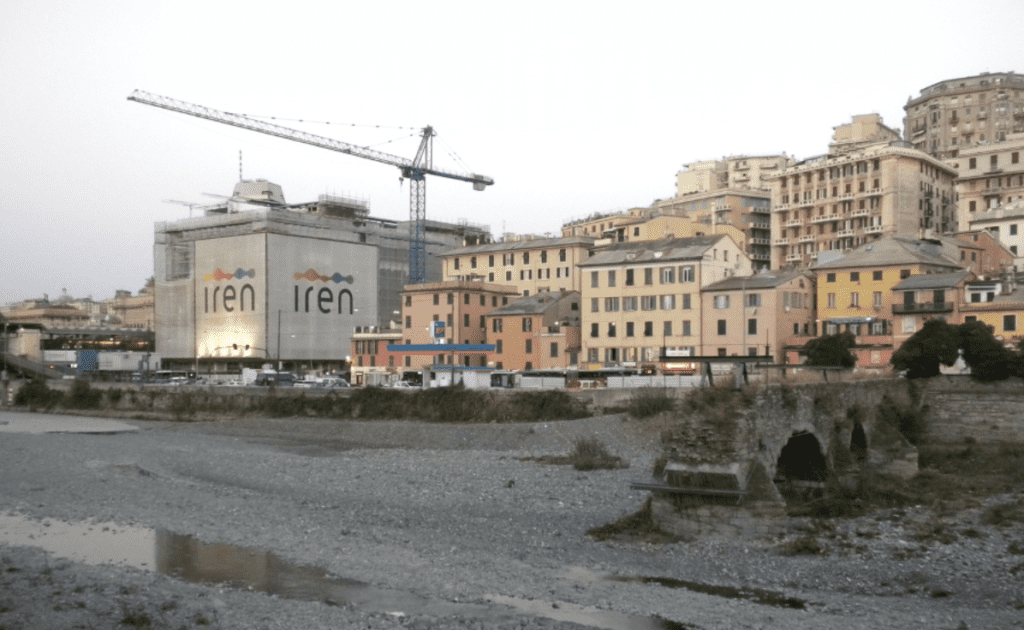
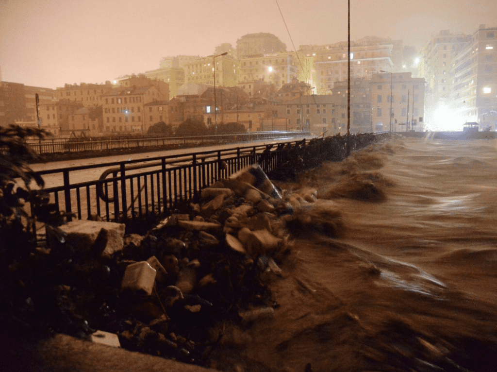
The Bisagno is the main river flowing through the eastern part of the city. The waterway is a seasonal stream, being dry for the majority of the year and reaching its water’s volume peaks in October, the wettest month. The configuration of the valley exposes the Bisagno to flash flooding events. In fact the waterway’s source is only 25 km away from the outlet and the river flows through remarkably steep landscapes. Historically the river has flooded periodically. Nowadays the waterway still represents a threat to citizens due to urban expansion patterns modifying the hydrographical network and climate change effects responsible for more intense rain events. The flooding of 2011 and 2014 killed many people and destroyed houses, commercial business and infrastructure.
Synergies and Challenges
The Bisagno did not play a crucial role in the first stages of Genova’s development, since before the Roman times up until the nineteenth century, the town was centered around the harbor and the river only functioned as its eastern border. From the nineteenth century on Genova expanded toward the waterway and its plain. The riversides slowly populated with dwellers focusing on agricultural activities. Still nowadays the local dialect word for vegetables and fruit vendors is “Bezagnin”, a clear reference to the traditional provenience of such products. By 1970 a lot of changes happened when the railway was built and industrialization reached the city. Genova’s dynamics changed and urbanization drastically spread along the river.
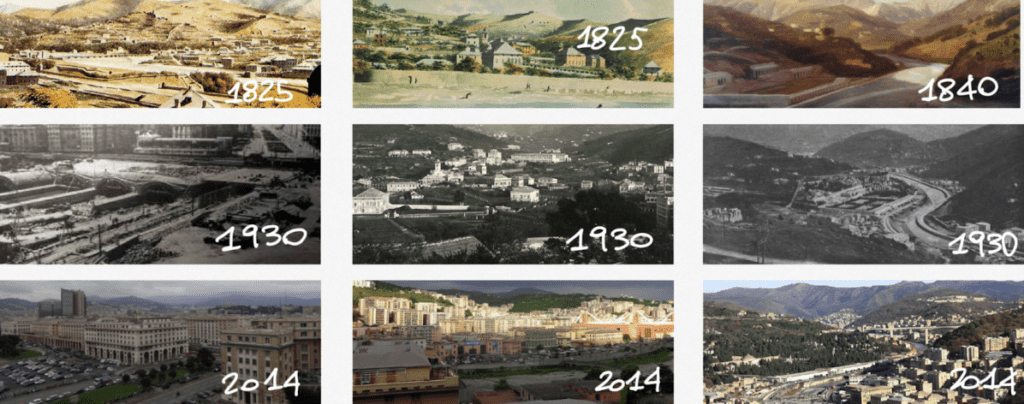
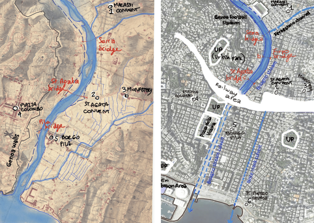
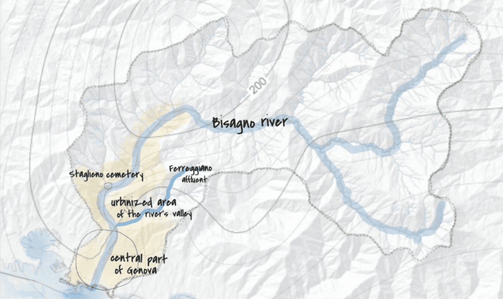
The plain, located in the city center, represented a precious flat surface for development within a hilly context. Consequently the city decided to build a culvert infrastructure and bury the river outlet under the expansion of the two central neighborhoods of Brignole and La Foce. Multiple segments of the river have been constrained and directed through channelization processes as a result of the city enlargement.
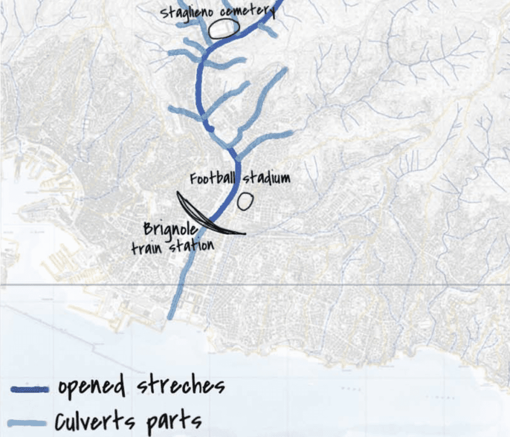
Roads and houses have been constructed all along the banks in response to population growth. Such practices have been pushed to extreme levels, gradually causing the loss of the already limited connection between the inhabitants and the waterway. Initially citizens tried to take back ownership of the riverbed and urban farming activities were commonly found in the dried stream. However, the municipality had to forbid such practices when debris started playing a significant role in flooding.
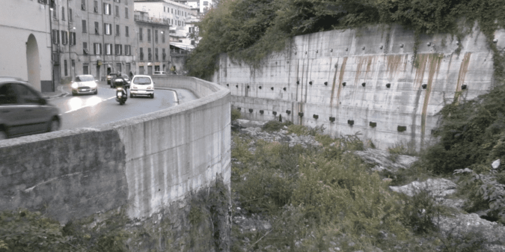
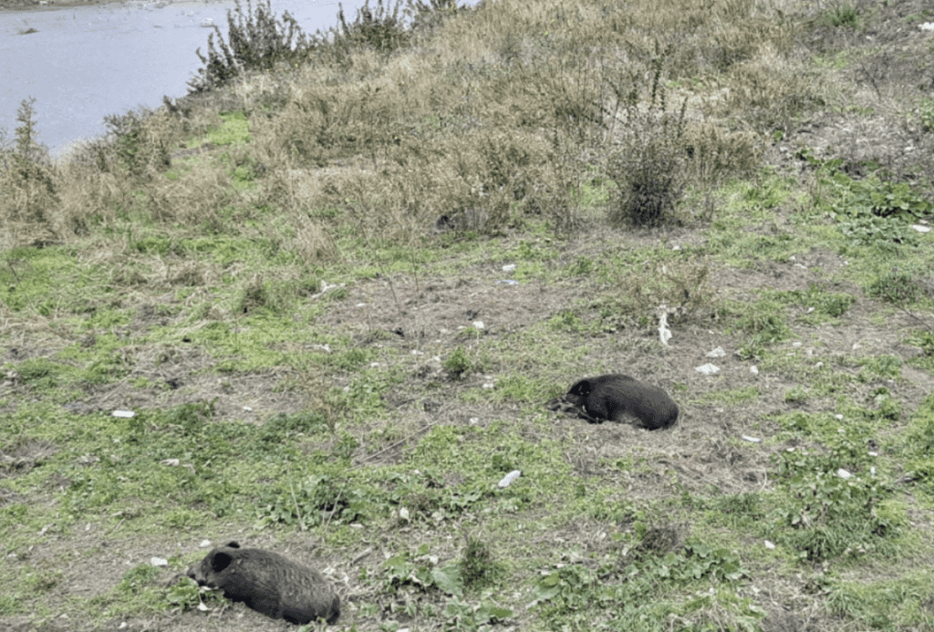
Maintaining the riverbed still represents a challenge for contemporary city managers. People use the waterway as a dumpsite and nature grows uncontrolled within the river banks. The green strip is not accessible to residents and functions as a connection between the city and the nearby hills only for wild boars. In fact recently, boars have started to utilize the dried river to roam down to the city, causing issues in various neighborhoods.
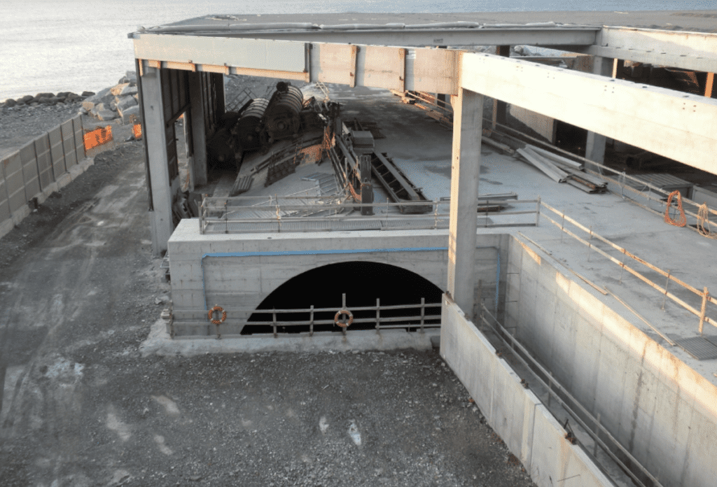
The city’s overall approach to the river has shaped the modern waterway’s narrative: citizens ignore the Bisagno and cyclically fear it when rainfalls suddenly intensify. Currently, the municipality is involved in mitigation strategies aligned with the above mentioned philosophy. In 2020 the city started an extension of the existing culvert system. The three planners who worked on the original project underestimated the capacity of the river. A new culvert is now being built to divert the Fereggiano stream (one of the main tributaries of the Bisagno) to the sea before it reaches the river. The new infrastructure system should be completed in 2024 and aims to release pressure from the Bisagno and decrease the chances of future flooding.
Conclusions
The contemporary river management approach of Genova did not take into consideration the possibility of shifting mentality and addressing the relationship between the Bisagno and the city in a more holistic way. Approaches for diversified interventions, engineer or landscape centered, have not been considered. The re-naturalization of the river was never discussed when deciding which measures to take in response to the most recent flooding events. However, at the current stage of development it is hard to imagine a more integrated future for the river. Where would all the residents now living in the river banks go in the circumstances of a river focused approach? Is there a possibility for the Bisagno to become a valued element of Genova’s urban structure? Could the river in the future evolve into an economic or recreational asset for the city? The answers to those questions are complex and would imply major transformations. Meanwhile Genova has lost its river and the situation will stay immutable until a new vision of the synergy between the city and the Bisagno is developed.


